
Mackenzie topographic map
Interactive map
Click on the map to display elevation.
About this map
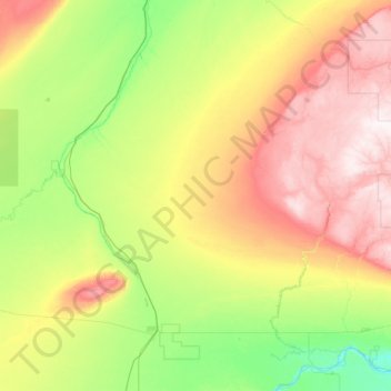
Name: Mackenzie topographic map, elevation, terrain.
Location: Mackenzie, Alberta, Canada (58.32329 -117.50865 59.60329 -116.22865)
Average elevation: 458 m
Minimum elevation: 244 m
Maximum elevation: 996 m
Other topographic maps
Click on a map to view its topography, its elevation and its terrain.