
Thank you for supporting this site ❤️
Make a donation
Make a donation
Ford City topographic map
Click on the map to display elevation.
Thank you for supporting this site ❤️
Make a donation
Make a donation
About this map
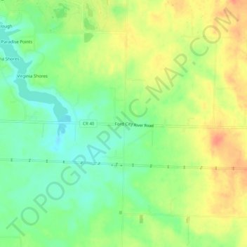
Name: Ford City topographic map, elevation, terrain.
Location: Ford City, Colbert County, Alabama, United States (34.76592 -87.54864 34.80592 -87.50864)
Average elevation: 176 m
Minimum elevation: 153 m
Maximum elevation: 201 m
Thank you for supporting this site ❤️
Make a donation
Make a donation
Other topographic maps
Click on a map to view its topography, its elevation and its terrain.