
Thank you for supporting this site ❤️
Make a donation
Make a donation
Inwood topographic map
Click on the map to display elevation.
Thank you for supporting this site ❤️
Make a donation
Make a donation
About this map
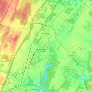
Name: Inwood topographic map, elevation, terrain.
Location: Inwood, Berkeley County, West Virginia, United States (39.33764 -78.08216 39.36677 -78.02825)
Average elevation: 176 m
Minimum elevation: 135 m
Maximum elevation: 217 m
Thank you for supporting this site ❤️
Make a donation
Make a donation
Other topographic maps
Click on a map to view its topography, its elevation and its terrain.
West Martinsburg Historic District
United States > West Virginia > Berkeley County > Martinsburg > Rosemont
Average elevation: 149 m
Thank you for supporting this site ❤️
Make a donation
Make a donation
Berkeley Place
United States > West Virginia > Berkeley County > Martinsburg > Berkeley Place
Average elevation: 142 m