
Rocha topographic map
Interactive map
Click on the map to display elevation.
About this map
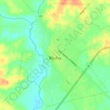
Name: Rocha topographic map, elevation, terrain.
Location: Rocha, 27000, Uruguay (-34.50408 -54.35769 -34.45507 -54.29423)
Average elevation: 23 m
Minimum elevation: 3 m
Maximum elevation: 57 m
Other topographic maps
Click on a map to view its topography, its elevation and its terrain.