
Rocha topographic map
Interactive map
Click on the map to display elevation.
About this map
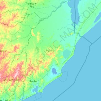
Name: Rocha topographic map, elevation, terrain.
Location: Rocha, Uruguay (-34.80180 -54.57912 -33.15083 -53.36942)
Average elevation: 46 m
Minimum elevation: -4 m
Maximum elevation: 486 m
Other topographic maps
Click on a map to view its topography, its elevation and its terrain.