
Moungo topographic map
Interactive map
Click on the map to display elevation.
About this map
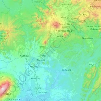
Name: Moungo topographic map, elevation, terrain.
Location: Moungo, Littoral, Cameroon (4.06527 9.41089 5.33501 10.10962)
Average elevation: 472 m
Minimum elevation: -3 m
Maximum elevation: 4,005 m
Other topographic maps
Click on a map to view its topography, its elevation and its terrain.