
Ajmer Tehsil topographic map
Interactive map
Click on the map to display elevation.
About this map
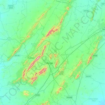
Name: Ajmer Tehsil topographic map, elevation, terrain.
Location: Ajmer Tehsil, Ajmer, Rajasthan, India (26.31173 74.38173 26.70472 74.82840)
Average elevation: 469 m
Minimum elevation: 387 m
Maximum elevation: 878 m
Other topographic maps
Click on a map to view its topography, its elevation and its terrain.