
Thank you for supporting this site ❤️
Make a donation
Make a donation
Gysenberg topographic map
Click on the map to display elevation.
Thank you for supporting this site ❤️
Make a donation
Make a donation
About this map
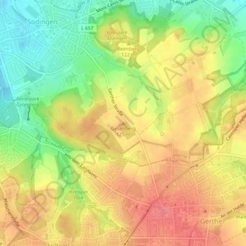
Name: Gysenberg topographic map, elevation, terrain.
Location: Gysenberg, Herne, Nordrhein-Westfalen, 44627, Deutschland (51.52882 7.27096 51.52892 7.27106)
Average elevation: 111 m
Minimum elevation: 70 m
Maximum elevation: 143 m
Thank you for supporting this site ❤️
Make a donation
Make a donation
Other topographic maps
Click on a map to view its topography, its elevation and its terrain.