
Make a donation
Mountain Home topographic map
Click on the map to display elevation.
Make a donation
About this map
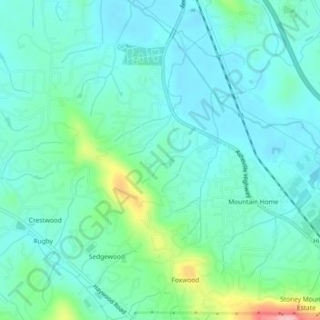
Name: Mountain Home topographic map, elevation, terrain.
Average elevation: 654 m
Minimum elevation: 620 m
Maximum elevation: 782 m
Make a donation
Other topographic maps
Click on a map to view its topography, its elevation and its terrain.
Mills River
United States > North Carolina > Henderson County > Mills River > Oak Hill Court
Average elevation: 633 m
Make a donation
Flat Rock Forest
United States > North Carolina > Henderson County > Flat Rock
Average elevation: 681 m
Make a donation
Patton Park
United States > North Carolina > Henderson County > Hendersonville
Average elevation: 655 m
Echo Lake
United States > North Carolina > Henderson County > Laurel Park > Country Ridge
Average elevation: 760 m
Make a donation
Glassy Mountain
United States > North Carolina > Henderson County > Flat Rock
Average elevation: 718 m
Make a donation
Willow Wew
United States > North Carolina > Henderson County > Hendersonville
Average elevation: 667 m
Make a donation
Make a donation
Carolina Village
United States > North Carolina > Henderson County > Hendersonville > Carolina Village
Average elevation: 650 m
Mills River
United States > North Carolina > Henderson County > Mills River > Oak Hill Court
Average elevation: 644 m
Wildwood Heights
United States > North Carolina > Henderson County > Laurel Park
Average elevation: 757 m
Make a donation