
Thank you for supporting this site ❤️
Make a donation
Make a donation
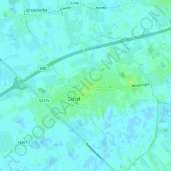
Gistel topographic map
Click on the map to display elevation.
Thank you for supporting this site ❤️
Make a donation
Make a donation
Gistel
Het stadje Gistel is zonder twijfel de bakermat van de Godelieveverering in Vlaanderen en Noord-Frankrijk. Hoogtepunt in de verering is de St.-Godelieveprocessie. Deze gaat uit door het dorpscentrum op de eerste zondag na 6 juli.
Thank you for supporting this site ❤️
Make a donation
Make a donation
About this map
Name: Gistel topographic map, elevation, terrain.
Location: Gistel, Oostende, West-Vlaanderen, Vlaanderen, 8470, België (51.13432 2.92133 51.18197 3.00055)
Average elevation: 2 m
Minimum elevation: -2 m
Maximum elevation: 10 m
Thank you for supporting this site ❤️
Make a donation
Make a donation
Other topographic maps
Click on a map to view its topography, its elevation and its terrain.
Thank you for supporting this site ❤️
Make a donation
Make a donation
Thank you for supporting this site ❤️
Make a donation
Make a donation
Thank you for supporting this site ❤️
Make a donation
Make a donation
De Meiboom
België > West-Vlaanderen > Oostende > Oudenburg > Roksem > De Meiboom
Average elevation: 6 m