
Thank you for supporting this site ❤️
Make a donation
Make a donation
Minco topographic map
Click on the map to display elevation.
Thank you for supporting this site ❤️
Make a donation
Make a donation
About this map
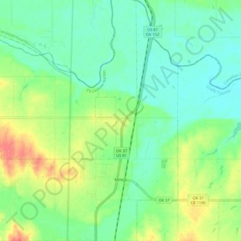
Name: Minco topographic map, elevation, terrain.
Location: Minco, Grady County, Oklahoma, 73059, United States (35.29072 -97.99966 35.37564 -97.91825)
Average elevation: 395 m
Minimum elevation: 375 m
Maximum elevation: 434 m
Thank you for supporting this site ❤️
Make a donation
Make a donation
Other topographic maps
Click on a map to view its topography, its elevation and its terrain.