
Reculver topographic map
Click on the map to display elevation.
About this map
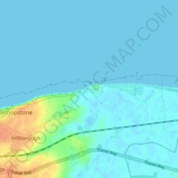
Name: Reculver topographic map, elevation, terrain.
Location: Reculver, Canterbury, Kent, England, CT6 6SU, United Kingdom (51.35872 1.17784 51.39872 1.21784)
Average elevation: 5 m
Minimum elevation: -1 m
Maximum elevation: 37 m
Other topographic maps
Click on a map to view its topography, its elevation and its terrain.
Reculver Country Park
United Kingdom > England > Kent > Canterbury > Hillborough
Average elevation: 10 m