
Thank you for supporting this site ❤️
Make a donation
Make a donation
Trenton topographic map
Click on the map to display elevation.
Thank you for supporting this site ❤️
Make a donation
Make a donation
About this map
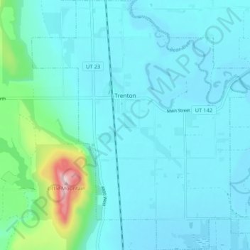
Name: Trenton topographic map, elevation, terrain.
Location: Trenton, Cache County, Utah, 84338, United States (41.88119 -111.97285 41.94091 -111.90388)
Average elevation: 1,392 m
Minimum elevation: 1,345 m
Maximum elevation: 1,731 m
Thank you for supporting this site ❤️
Make a donation
Make a donation
Other topographic maps
Click on a map to view its topography, its elevation and its terrain.