
Thank you for supporting this site ❤️
Make a donation
Make a donation
Grassland topographic map
Click on the map to display elevation.
Thank you for supporting this site ❤️
Make a donation
Make a donation
About this map
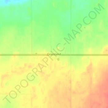
Name: Grassland topographic map, elevation, terrain.
Location: Grassland, Athabasca County, Alberta, T0A 1V0, Canada (54.80056 -112.70583 54.84056 -112.66583)
Average elevation: 584 m
Minimum elevation: 558 m
Maximum elevation: 605 m
Thank you for supporting this site ❤️
Make a donation
Make a donation
Other topographic maps
Click on a map to view its topography, its elevation and its terrain.