
Oupeye topographic map
Interactive map
Click on the map to display elevation.
About this map
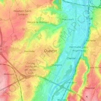
Name: Oupeye topographic map, elevation, terrain.
Location: Oupeye, Liège, Wallonie, 4680, Belgique (50.66919 5.60507 50.74919 5.68507)
Average elevation: 113 m
Minimum elevation: 51 m
Maximum elevation: 188 m
Other topographic maps
Click on a map to view its topography, its elevation and its terrain.