
Vivegnis topographic map
Interactive map
Click on the map to display elevation.
About this map
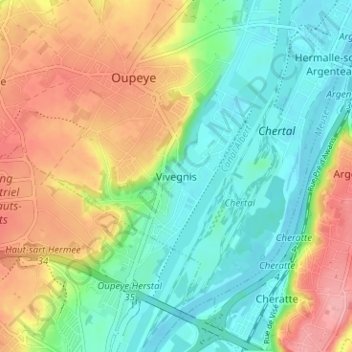
Name: Vivegnis topographic map, elevation, terrain.
Location: Vivegnis, Oupeye, Liège, Wallonie, 4680, Belgique (50.67793 5.63271 50.71793 5.67271)
Average elevation: 94 m
Minimum elevation: 53 m
Maximum elevation: 155 m
Other topographic maps
Click on a map to view its topography, its elevation and its terrain.