
Thank you for supporting this site ❤️
Make a donation
Make a donation
Hyrum topographic map
Click on the map to display elevation.
Thank you for supporting this site ❤️
Make a donation
Make a donation
About this map
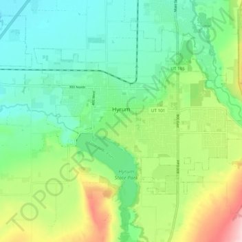
Name: Hyrum topographic map, elevation, terrain.
Location: Hyrum, Cache County, Utah, 84319, United States (41.60884 -111.88993 41.65219 -111.79386)
Average elevation: 1,439 m
Minimum elevation: 1,359 m
Maximum elevation: 1,619 m
Thank you for supporting this site ❤️
Make a donation
Make a donation
Other topographic maps
Click on a map to view its topography, its elevation and its terrain.