
Thank you for supporting this site ❤️
Make a donation
Make a donation
Onslunda topographic map
Click on the map to display elevation.
Thank you for supporting this site ❤️
Make a donation
Make a donation
About this map
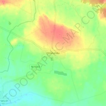
Name: Onslunda topographic map, elevation, terrain.
Location: Onslunda, Tomelilla kommun, Skåne County, 273 95, Sweden (55.57849 14.03029 55.61849 14.07029)
Average elevation: 101 m
Minimum elevation: 77 m
Maximum elevation: 131 m
Thank you for supporting this site ❤️
Make a donation
Make a donation
Other topographic maps
Click on a map to view its topography, its elevation and its terrain.