
Naryn Region topographic map
Interactive map
Click on the map to display elevation.
About this map
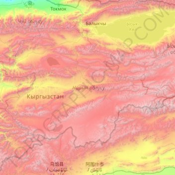
Name: Naryn Region topographic map, elevation, terrain.
Location: Naryn Region, Kyrgyzstan (40.27979 73.71177 42.45455 77.90499)
Average elevation: 2,789 m
Minimum elevation: 653 m
Maximum elevation: 5,811 m
Other topographic maps
Click on a map to view its topography, its elevation and its terrain.