
Jama'Are topographic map
Interactive map
Click on the map to display elevation.
About this map
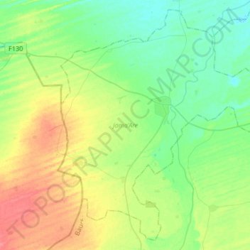
Name: Jama'Are topographic map, elevation, terrain.
Location: Jama'Are, Bauchi, Nigeria (11.53222 9.81720 11.77014 10.07995)
Average elevation: 403 m
Minimum elevation: 384 m
Maximum elevation: 437 m
Other topographic maps
Click on a map to view its topography, its elevation and its terrain.
Rahama Bauchi
Nigeria > Bauchi > Rahama > Rahama Bauchi
Rahama Bauchi, Rahama, Toro, Bauchi, Nigeria
Average elevation: 781 m
Dass
Nigeria > Bauchi > Bununu Central > Dass
Dass, Bununu Central, Dass, Bauchi, Nigeria
Average elevation: 658 m