
Make a donation
Mirror Lake topographic map
Click on the map to display elevation.
Make a donation
About this map
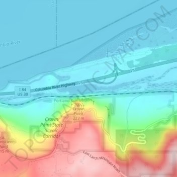
Name: Mirror Lake topographic map, elevation, terrain.
Location: Mirror Lake, Multnomah County, Oregon, United States (45.54130 -122.24908 45.54327 -122.23300)
Average elevation: 89 m
Minimum elevation: -1 m
Maximum elevation: 334 m
Make a donation
Other topographic maps
Click on a map to view its topography, its elevation and its terrain.
Make a donation
Forest Park
United States > Oregon > Multnomah County > Portland
Solidified lava from Grande Ronde members of the Columbia River Basalt Group underlie Forest Park. About 16 million years ago during the Middle Miocene, the Columbia River ran through a lowland south of its modern channel. Eruptions from linear vents in eastern Oregon and Washington flowed down this channel…
Average elevation: 91 m
Make a donation
Make a donation
Make a donation
Powell Butte
United States > Oregon > Multnomah County > Portland
Powell Butte is located in Multnomah County in the U.S. state of Oregon. According to the U.S. National Geodetic Survey, the butte reaches an elevation of 614 feet (187 m), while the Geographic Names Information System lists the mountain's elevation at 627 feet (191 m). J.E. Allen, an emeritus professor of…
Average elevation: 105 m
Multnomah Falls
United States > Oregon > Multnomah County
The falls drops in two major steps, split into an upper falls of 542 feet (165 m) and a lower falls of 69 feet (21 m), with a gradual 9 foot (3 m) drop in elevation between the two, so the total height of the waterfall is conventionally given as 620 feet (189 m). The two drops are due to a zone of more easily…
Average elevation: 270 m
Make a donation
Make a donation
Make a donation