
Mountains topographic map
Interactive map
Click on the map to display elevation.
About this map
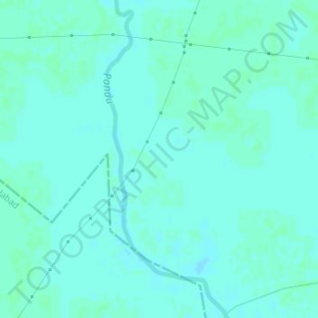
Name: Mountains topographic map, elevation, terrain.
Location: Mountains, Kānpur, Kanpur Dehat, Uttar Pradesh, India (26.75541 79.95708 26.75551 79.95718)
Average elevation: 135 m
Minimum elevation: 133 m
Maximum elevation: 137 m
Other topographic maps
Click on a map to view its topography, its elevation and its terrain.
Nizamabad
Nizamabad, Azamgarh, Uttar Pradesh, 276305, India
Average elevation: 81 m
Poonch
India > Uttar Pradesh > Poonch
Poonch, Jhānsi, Jhansi, Uttar Pradesh, India
Average elevation: 163 m
Maghar
India > Uttar Pradesh > Maghar
Maghar, Sait Kibir Nagar, Uttar Pradesh, 272173, India
Average elevation: 77 m
Greater Noida
India > Uttar Pradesh > Greater Noida
Greater Noida, Gautam Buddha Nagar, Uttar Pradesh, 201310, India
Average elevation: 203 m
Palia
India > Uttar Pradesh > Palia
Palia, Kheri, Uttar Pradesh, 262902, India
Average elevation: 157 m
Radha Kund
India > Uttar Pradesh > Radha Kund
Radha Kund, Mathura, Uttar Pradesh, 281502, India
Average elevation: 181 m
Noida
India > Uttar Pradesh > Noida
Noida, Ghaziabad, Uttar Pradesh, 201301, India
Average elevation: 213 m