
Thank you for supporting this site ❤️
Make a donation
Make a donation
Yewa South topographic map
Click on the map to display elevation.
Thank you for supporting this site ❤️
Make a donation
Make a donation
About this map
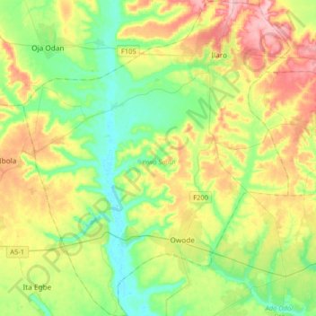
Name: Yewa South topographic map, elevation, terrain.
Location: Yewa South, Ogun State, Nigeria (6.61982 2.81924 6.94228 3.09336)
Average elevation: 53 m
Minimum elevation: 1 m
Maximum elevation: 142 m
Thank you for supporting this site ❤️
Make a donation
Make a donation
Other topographic maps
Click on a map to view its topography, its elevation and its terrain.
Thank you for supporting this site ❤️
Make a donation
Make a donation
Thank you for supporting this site ❤️
Make a donation
Make a donation