
Thank you for supporting this site ❤️
Make a donation
Make a donation
Ogun Waterside topographic map
Click on the map to display elevation.
Thank you for supporting this site ❤️
Make a donation
Make a donation
About this map
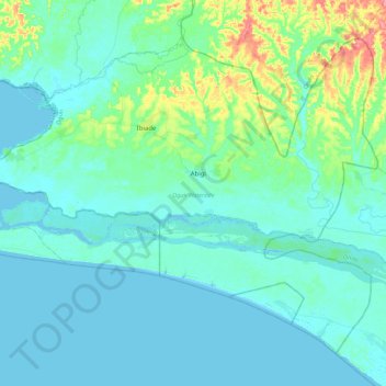
Name: Ogun Waterside topographic map, elevation, terrain.
Location: Ogun Waterside, Ogun State, Nigeria (6.28020 4.15501 6.64512 4.60605)
Average elevation: 12 m
Minimum elevation: -2 m
Maximum elevation: 83 m
Thank you for supporting this site ❤️
Make a donation
Make a donation
Other topographic maps
Click on a map to view its topography, its elevation and its terrain.
Thank you for supporting this site ❤️
Make a donation
Make a donation
Thank you for supporting this site ❤️
Make a donation
Make a donation