
Hachinohe topographic map
Interactive map
Click on the map to display elevation.
About this map
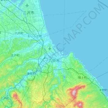
Name: Hachinohe topographic map, elevation, terrain.
Location: Hachinohe, Préfecture d'Aomori, Japon (40.34736 141.35448 40.72181 141.85796)
Average elevation: 72 m
Minimum elevation: -2 m
Maximum elevation: 728 m
Other topographic maps
Click on a map to view its topography, its elevation and its terrain.
Fujikawaguchiko
Japon > District de Minamitsuru
Fujikawaguchiko, District de Minamitsuru, Préfecture de Yamanashi, Chūbu, Japon
Average elevation: 1,117 m