
Thank you for supporting this site ❤️
Make a donation
Make a donation
Abeokuta North topographic map
Click on the map to display elevation.
Thank you for supporting this site ❤️
Make a donation
Make a donation
About this map
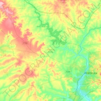
Name: Abeokuta North topographic map, elevation, terrain.
Location: Abeokuta North, Ogun State, Nigeria (7.05421 3.00103 7.41619 3.36366)
Average elevation: 102 m
Minimum elevation: 15 m
Maximum elevation: 240 m
Thank you for supporting this site ❤️
Make a donation
Make a donation
Other topographic maps
Click on a map to view its topography, its elevation and its terrain.
Thank you for supporting this site ❤️
Make a donation
Make a donation
Thank you for supporting this site ❤️
Make a donation
Make a donation