
Tuvalu topographic map
Interactive map
Click on the map to display elevation.
Tuvalu
Tuvalu is a volcanic archipelago, and consists of three reef islands (Nanumanga, Niutao and Niulakita) and six true atolls (Funafuti, Nanumea, Nui, Nukufetau, Nukulaelae and Vaitupu). Its small, scattered group of low-lying atolls have poor soil and a total land area of only about 26 square kilometres (10 square miles) making it the fourth smallest country in the world. The highest elevation is 4.6 metres (15 ft) above sea level on Niulakita; however the low-lying atolls and reef islands of Tuvalu are susceptible to seawater flooding during cyclones and storms. The sea level at the Funafuti tide gauge has risen at 3.9 mm per year, which is approximately twice the global average. However, over four decades, there had been a net increase in land area of the islets of 0.74 square kilometres (0.3 square miles) (2.9%), although the changes are not uniform, with 74% increasing and 27% decreasing in size. A 2018 report stated that the rising sea levels are identified as creating an increased transfer of wave energy across reef surfaces, which shifts sand, resulting in accretion to island shorelines. The Tuvalu Prime Minister objected to the report's implication that there were "alternate" strategies for Islanders to adapt to rising sea levels, and criticised it for neglecting issues such as saltwater intrusion into groundwater tables as a result of sea level rise.
About this map
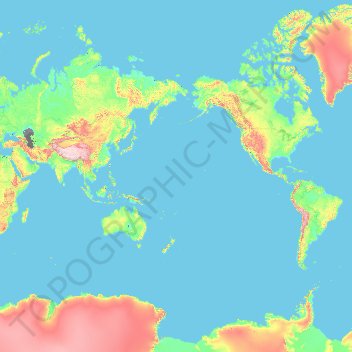
Name: Tuvalu topographic map, elevation, terrain.
Location: Tuvalu (-10.99394 -180.00000 -5.43696 180.00000)
Average elevation: 381 m
Minimum elevation: -29 m
Maximum elevation: 6,143 m
Other topographic maps
Click on a map to view its topography, its elevation and its terrain.
Ђаловића клисура
Serbia > Central Serbia > Zlatibor Administrative District > Sjenica Municipality > Crvsko
Average elevation: 1,091 m
Africa
Average elevation: 462 m
Fouta Djallon
Guinea > Mamou Region > Pita Prefecture
Fouta-Djallon consists mainly of rolling grasslands, at an average elevation of about 900 m (3,000 ft). The highest point, Mount Loura, rises to 1,515 m (4,970 ft). The plateau consists of thick sandstone formations that overlie granitic basement rock. Erosion by rain and rivers has carved deep jungle canyons…
Average elevation: 1,143 m
Erickson
Canada > British Columbia > Regional District of Central Kootenay > Area B (Goat River Valley)
Average elevation: 680 m
Erg Chech
It is an almost uninhabited part of the greater Sahara Desert, an inhospitable desert region with long, extremely hot summers and short, very warm winters. The Erg Chech is a vast sandy expanse including compound and complex linear and star dunes. The mean elevation of the Erg Chech is just above 300 m,…
Average elevation: 335 m
Mount Rainier
United States > Washington > Pierce County
Mount Rainier (/reɪˈnɪər/ ray-NEER), also known as Tahoma, is a large active stratovolcano in the Cascade Range of the Pacific Northwest in the United States. The mountain is located in Mount Rainier National Park about 59 miles (95 km) south-southeast of Seattle. With an officially recognized summit…
Average elevation: 3,911 m
Mount Nimba Strict Nature Reserve
Guinea > Nzérékoré Region > Lola Prefecture
The Nimba Range has a sub-equatorial montane climate. Temperature changes extremely with altitude, with a daytime maximum ranging between 24 °C and 33 °C, and the nightly minimum can fall below 10 °C. Some parts of the reserve receive significantly less precipitation, due to rain-shadow effect of the high…
Average elevation: 657 m
Kharagpur
India > West Bengal > Kharagpur-I
Kharagpur is the fourth largest city of West Bengal in area after Kolkata, Durgapur and Asansol. It is also the fifth most populated city of West Bengal after Kolkata, Asansol, Siliguri, Durgapur - located at 22°19′49″N 87°19′25″E / 22.330239°N 87.323653°E / 22.330239; 87.323653, covering…
Average elevation: 39 m
Agodi gate water corporation
Nigeria > Oyo State > Ibadan North East > Ibadan
Average elevation: 228 m
Ponticelli
Ponticelli is a frazione of the comune of Città della Pieve in the Province of Perugia, Umbria, central Italy. It stands at an elevation of 249 metres above sea level. At the time of the Istat census of 2001 it had 610 inhabitants.
Average elevation: 275 m
Ngong
Kenya > Kajiado County > Kajiado North > Ngong ward
As of 2019, the population of Ngong Town consisting of Enchorro-Emunyi and Ngong Township locations was 25,866. The elevation of Ngong Town is 1,961 meters in altitude, but the altitude of the hills is about 2,460 meters above sea level. Ngong was the central town of Ngong division when Kajiado County was a…
Average elevation: 1,951 m
Nestor Falls
Canada > Ontario > Kenora District > Sioux Narrows-Nestor Falls Township
Average elevation: 337 m