
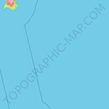
Andaman topographic map
Interactive map
Click on the map to display elevation.
About this map
Name: Andaman topographic map, elevation, terrain.
Location: Andaman, India (9.36011 92.36002 10.64011 93.64002)
Average elevation: 1 m
Minimum elevation: 0 m
Maximum elevation: 149 m
Other topographic maps
Click on a map to view its topography, its elevation and its terrain.
Mumbai
India > Maharashtra > Mumbai
Mumbai is on a narrow peninsula on the southwest of Salsette Island, which lies between the Arabian Sea to the west, Thane Creek to the east and Vasai Creek to the north. Mumbai's suburban district occupies most of the island. Navi Mumbai is east of Thane Creek and Thane is north of Vasai Creek. Mumbai…
Average elevation: 19 m
Madurai
India > Tamil Nadu > Madurai South
Madurai is located at 9°56′N 78°07′E / 9.93°N 78.12°E / 9.93; 78.12. It has an average elevation of 134 metres. The city of Madurai lies on the flat and fertile plain of the river Vaigai, which runs in the northwest–southeast direction through the city, dividing it into two almost equal…
Average elevation: 137 m
Chennai
Chennai is located on the south–eastern coast of India in the north–eastern part of Tamil Nadu on a flat coastal plain known as the Eastern Coastal Plains with an average elevation of 6.7 m (22 ft) and highest point at 60 m (200 ft). Chennai's soil is mostly clay, shale and sandstone. Clay underlies most…
Average elevation: 7 m
Chandigarh
Chandigarh is located by the foothills of the Shivalik Range of the Himalayas in northwest India. It covers an area of approximately 114 km2. It borders the states of Punjab and Haryana. The exact geographic coordinates of Chandigarh are 30°44′N 76°47′E / 30.74°N 76.79°E / 30.74; 76.79. It has…
Average elevation: 343 m
Kalaburagi
India > Karnataka > Kalaburagi taluku > Kalaburagi
The entire district is on the Deccan Plateau, and the elevation ranges from 300 to 750 m above MSL. Two main rivers, the Krishna and Bhima, flow through the district. The predominant soil type is black soil. The district has many tanks, which irrigate the land along with the river. The Upper Krishna Project is…
Average elevation: 465 m