Netherlands topographic map
Interactive map
Click on the map to display elevation.
Netherlands
Netherlands literally means 'lower countries' in reference to its low elevation and flat topography, with only about 50% of its land exceeding 1 metre (3 ft 3 in) above sea level, and nearly 17% falling below sea level. Most of the areas below sea level, known as polders, are the result of land reclamation that began in the 16th century. With a population of 17.34 million people, all living within a total area of roughly 41,500 square kilometres (16,000 sq mi)—of which the land area is 33,700 square kilometres (13,000 sq mi)—the Netherlands is one of the most densely populated countries in the world. Nevertheless, it is the world's second-largest exporter of food and agricultural products (after the United States), owing to its fertile soil, mild climate, and intensive agriculture.
About this map
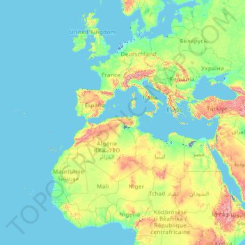
Name: Netherlands topographic map, elevation, terrain.
Location: Netherlands (11.77700 -70.26959 53.74440 7.22750)
Average elevation: 251 m
Minimum elevation: -13 m
Maximum elevation: 3,972 m
Other topographic maps
Click on a map to view its topography, its elevation and its terrain.
Scafell Pike
United Kingdom > England > Cumberland
Scafell Pike (/ˈskɔːfɛl/) is a hill in the Lake District region of Cumbria, England. It has an elevation of 978 metres (3,209 ft) above sea level, making it the highest and the most prominent mountain in England. The mountain is part of the Scafell massif, an extinct volcano, and is one of the Southern Fells.
Average elevation: 679 m
Snowdon
United Kingdom > Wales > Gwynedd
Snowdon (/ˈsnoʊdən/), or Yr Wyddfa (Welsh: [ər ˈʊɨ̞̯ðva] ), is a mountain in Snowdonia in North Wales. It has an elevation of 1,085 metres (3,560 ft) above sea level, which makes it both the highest mountain in Wales and the highest in the British Isles south of the Scottish Highlands. Snowdon is…
Average elevation: 692 m
Lima
The suburban district of Cieneguilla, the district of Pachacámac and the district of Chosica provide important tourist attractions among locals. Due to its elevation (over 500 masl), the sun shines in Chosica during the winter, being very visited by the residents of Lima to escape the urban fog.
Average elevation: 236 m
Eifel
Germany > Rhineland-Palatinate > Landkreis Ahrweiler > Adenau
The Eifel is in the Atlantic climate zone with its relatively high precipitation; winters that are moderately cold and long with periods of snow; and summers that are often humid and cool. The prevailing wind is west/southwest. A relatively dry and milder climate prevails in the wind and rain shadow of the…
Average elevation: 585 m
Klerksdorp
South Africa > North West > Dr Kenneth Kaunda District Municipality
Average elevation: 1,346 m
Stilfontein
South Africa > North West > Dr Kenneth Kaunda District Municipality > Matlosana Local Municipality
Average elevation: 1,346 m
Anfa Park منتزه أنفا
Morocco > Pachalik de Casablanca باشوية الدار البيضاء > Casablanca
Average elevation: 50 m
Quilchena
Canada > British Columbia > Thompson-Nicola Regional District > Area M (Beautiful Nicola Valley - North)
Average elevation: 677 m
Memari
India > West Bengal > Memari - I
Memari is located at 23°12′N 88°07′E / 23.2°N 88.12°E / 23.2; 88.12. It has an average elevation of 25 metres (82 feet).
Average elevation: 21 m
Matador Wildlife Management Area
United States > Texas > Cottle County > Paducah
Average elevation: 573 m
Europe
In general, Europe is not just colder towards the north compared to the south, but it also gets colder from the west towards the east. The climate is more oceanic in the west and less so in the east. This can be illustrated by the following table of average temperatures at locations roughly following the 64th,…
Average elevation: 223 m
Ankara
Ankara has a cold semi-arid climate under the Köppen climate classification (BSk), while under the Trewartha climate classification, the city is classified as humid continental (Dc). Due to its elevation and inland location, Ankara has cold and snowy winters, and hot and dry summers. Rainfall occurs mostly…
Average elevation: 1,082 m
Marcuello
Spain > Aragon > Hoya de Huesca / Plana de Uesca > Loarre > Linás de Marcuello
Average elevation: 863 m
Antalya
While the city itself only has modest elevation changes, Antalya has high mountains in all directions to its interior. With moisture being trapped, the local climate thus has high winter rainfall, while the interior bay setting results in very hot summers for a coastal city.
Average elevation: 117 m
Khandwa
India > Madhya Pradesh > Khandwa Nagar Tahsil
Khandwa is located at 21°50′N 76°20′E / 21.83°N 76.33°E / 21.83; 76.33. It has an average elevation of 313 metres (1026 feet).
Average elevation: 325 m
Skinnies Lake
United States > Michigan > Marquette County > Humboldt Township
Average elevation: 453 m
Ujjain
India > Madhya Pradesh > Ujjain NagarTahsil
Ujjain is located in the west-central part of India, and is north of the upper limit of the Vindhya mountain ranges. Located on the Malwa plateau, it is higher than the north Indian plains and the land rises towards the Vindhya Range to the south. Ujjain's coordinates are 23°10′N 75°46′E /…
Average elevation: 501 m
Fouta Djallon
Guinea > Mamou Region > Pita Prefecture
Fouta-Djallon consists mainly of rolling grasslands, at an average elevation of about 900 m (3,000 ft). The highest point, Mount Loura, rises to 1,515 m (4,970 ft). The plateau consists of thick sandstone formations that overlie granitic basement rock. Erosion by rain and rivers has carved deep jungle canyons…
Average elevation: 1,143 m
Ђаловића клисура
Serbia > Central Serbia > Zlatibor Administrative District > Sjenica Municipality > Crvsko
Average elevation: 1,091 m
Abuja
Nigeria > Federal Capital Territory > Municipal Area Council
The elevation is 360 metres (1,180 ft).
Average elevation: 508 m
Africa
Average elevation: 462 m
Erickson
Canada > British Columbia > Regional District of Central Kootenay > Area B (Goat River Valley)
Average elevation: 680 m
Mount Rainier
United States > Washington > Pierce County
Mount Rainier (/reɪˈnɪər/ ray-NEER), also known as Tahoma, is a large active stratovolcano in the Cascade Range of the Pacific Northwest in the United States. The mountain is located in Mount Rainier National Park about 59 miles (95 km) south-southeast of Seattle. With an officially recognized summit…
Average elevation: 3,911 m
Erg Chech
It is an almost uninhabited part of the greater Sahara Desert, an inhospitable desert region with long, extremely hot summers and short, very warm winters. The Erg Chech is a vast sandy expanse including compound and complex linear and star dunes. The mean elevation of the Erg Chech is just above 300 m,…
Average elevation: 335 m
